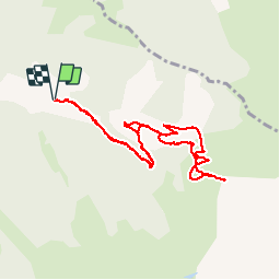
![](/images/other/stat-length.png)
![Tocht Sneeuwschoenen Le Port - RQ-Hameau de Goutets - Photo](https://media.geolcdn.com/t/1900/400/ext.pjpeg?maxdim=2&url=https%3A%2F%2Fservices.sitytrail.com%2FGeolivesWS%2FDownloadMedia.ashx%3FTrailID%3D912652%26Media%3Dfb06a675-7360-421d-ae6f-8a1a919c4e08.jpg)
RQ-Hameau de Goutets
Polo-31
Gebruiker
![Lengte](/images/other/stat-length.png)
![Max. hoogte](https://static1.geolcdn.com/siteimages/upload/files/1508320355ic_sort_altitude_max_24dp.png)
![Positief hoogteverschil](https://static1.geolcdn.com/siteimages/upload/files/1508320355ic_sort_den_pos_24dp.png)
![Km-Effort](/images/other/stat-length.png)
![Min. hoogte](https://static1.geolcdn.com/siteimages/upload/files/1508320355ic_sort_altitude_min_24dp.png)
![Negatief hoogteverschil](https://static1.geolcdn.com/siteimages/upload/files/1508320355ic_sort_den_neg_24dp.png)
![Boucle](https://static1.geolcdn.com/siteimages/upload/files/16400158638029165_repeat_loop_refresh_sync_direction_icon.png)
![Sneeuwschoenen](https://static1.geolcdn.com/sitytour/trail-icons/504.png)
4h00
Moeilijkheid : Gemakkelijk
![Scan deze QR-code om de tocht te openen in de SityTrail-applicatie](https://capi.geolives.com/qq0zvz2zws4bq2lad0pu/sitytour/trails/912652/qr.png?size=200)
Gratisgps-wandelapplicatie
Over ons
Tocht Sneeuwschoenen van 10,2 km beschikbaar op Occitanië, Ariège, Le Port. Deze tocht wordt voorgesteld door Polo-31.
Beschrijving
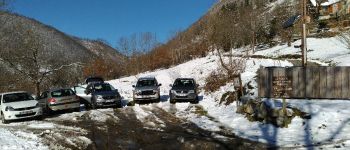
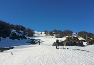
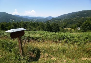
Accès : Depuis Massat, suivre la direction Port de lers par la D18 sur 4km, puis au niveau du Cimetière du village Le Port, prendre à gauche la D818 en direction de Le Carol sur près de 4km. Passer le Hameau de Trabeit Dessus. Le départ est au niveau du virage en épingle à gauche au-dessus de Trabiet Dessus (Quelques habitations sur la droites, et le départ du chemin de Goutets), se garer sur le petit parking randonneurs.
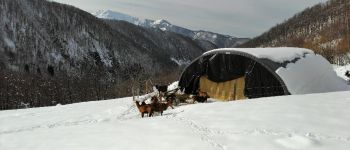
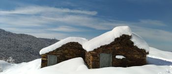
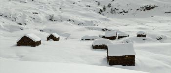
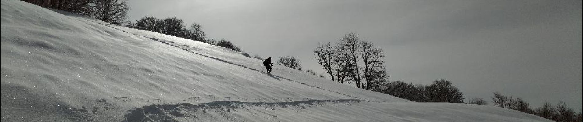
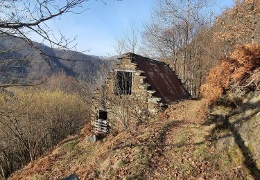
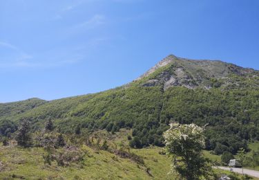
Le départ est dans le virage, au niveau des vieilles bâtisses. Emprunter le bon sentier qui part tout droit vers l'Est, pratiquement à plat. Suivre ce sentier qui chemine sans difficulté en fond de vallée. Après un grand lacet à gauche le chemin s'élève et sort de la forêt. Après le lacet suivant on traverse une grande zone découverte où se trouvent les granges de La Plagne. Continuer sur la piste qui nous élève en quelques lacets jusqu'aux premières habitations du hameau de Goutets.
Le retour s'effectue par le même itinéraire. Si l’enneigement est bon, il est possible à l'aller comme au retour de couper nombre de lacets et de jouer dans les pentes poudreuses.
Plaatsbepaling
Opmerkingen
Wandeltochten in de omgeving
![Tocht Stappen Le Port - jeudi 23 juillet 2020 - Photo](https://media.geolcdn.com/t/375/260/a9d8088f-d97f-4179-b327-b9a646087215.jpg&format=jpg&maxdim=2)
![Stappen Stappen](https://static1.geolcdn.com/sitytour/trail-icons/101.png)
Stappen
![](/images/other/stat-length.png)
![](https://static1.geolcdn.com/siteimages/upload/files/16400158638029165_repeat_loop_refresh_sync_direction_icon.png)
![Tocht Stappen Le Port - lundi 20 juillet 2020 - Photo](https://media.geolcdn.com/t/375/260/47c57c61-c926-4017-a7d6-399008dce335.jpg&format=jpg&maxdim=2)
![Stappen Stappen](https://static1.geolcdn.com/sitytour/trail-icons/101.png)
Stappen
![](/images/other/stat-length.png)
![](https://static1.geolcdn.com/siteimages/upload/files/16400158638029165_repeat_loop_refresh_sync_direction_icon.png)
![Tocht Stappen Le Port - les plagnols depuis foullie - Photo](https://media.geolcdn.com/t/375/260/ext.jpg?maxdim=2&url=https%3A%2F%2Fservices.sitytrail.com%2FGeolivesWS%2FDownloadMedia.ashx%3FTrailID%3D1012382%26Media%3Dfix__20180124114133.jpg)
![Stappen Stappen](https://static1.geolcdn.com/sitytour/trail-icons/101.png)
Stappen
![](/images/other/stat-length.png)
![](https://static1.geolcdn.com/siteimages/upload/files/16400158638029165_repeat_loop_refresh_sync_direction_icon.png)
![Tocht Stappen Le Port - les Plagnols depuis la Foullie - Photo](https://media.geolcdn.com/t/375/260/ext.jpg?maxdim=2&url=https%3A%2F%2Fservices.sitytrail.com%2FGeolivesWS%2FDownloadMedia.ashx%3FTrailID%3D893142%26Media%3Dfix__20180124114133.jpg)
![Stappen Stappen](https://static1.geolcdn.com/sitytour/trail-icons/101.png)
Stappen
![](/images/other/stat-length.png)
![](https://static1.geolcdn.com/siteimages/upload/files/16400158638029165_repeat_loop_refresh_sync_direction_icon.png)
![Tocht Stappen Le Port - le hameau des granges de Goutets - Photo](https://media.geolcdn.com/t/375/260/96a6eed6-cf7a-402b-a882-81bbaf442e4d.jpg&format=jpg&maxdim=2)
![Stappen Stappen](https://static1.geolcdn.com/sitytour/trail-icons/101.png)
Stappen
![](/images/other/stat-length.png)
![](https://static1.geolcdn.com/siteimages/upload/files/16400158638029165_repeat_loop_refresh_sync_direction_icon.png)
![Tocht Te voet Massat - Tour du Pic des Trois Seigneurs - Photo](https://media.geolcdn.com/t/375/260/ext.jpg?maxdim=2&url=https%3A%2F%2Fstatic1.geolcdn.com%2Fsiteimages%2Fupload%2Ffiles%2F1545311037marcheuse_200dpi.jpg)
![Te voet Te voet](https://static1.geolcdn.com/sitytour/trail-icons/100.png)
Te voet
![](/images/other/stat-length.png)
![](https://static1.geolcdn.com/siteimages/upload/files/16400158638029165_repeat_loop_refresh_sync_direction_icon.png)
![Tocht Stappen Massat - mardi 21 juillet 2020 - Photo](https://media.geolcdn.com/t/375/260/db2201e8-ee14-46e3-97bc-8b77e4b062b6.jpg&format=jpg&maxdim=2)
![Stappen Stappen](https://static1.geolcdn.com/sitytour/trail-icons/101.png)
Stappen
![](/images/other/stat-length.png)
![](https://static1.geolcdn.com/siteimages/upload/files/16400158638029165_repeat_loop_refresh_sync_direction_icon.png)
![Tocht Stappen Le Port - Ronde du Damian (petite) - Photo](https://media.geolcdn.com/t/375/260/fd49a987-73ac-4925-aed4-f8b2b84da7b9.jpg&format=jpg&maxdim=2)
![Stappen Stappen](https://static1.geolcdn.com/sitytour/trail-icons/101.png)
Stappen
![](/images/other/stat-length.png)
![](https://static1.geolcdn.com/siteimages/upload/files/16400158638029165_repeat_loop_refresh_sync_direction_icon.png)
![Tocht Sneeuwschoenen Le Port - col Dret et Tuc de Laguel - Photo](https://media.geolcdn.com/t/375/260/ext.jpg?maxdim=2&url=https%3A%2F%2Fservices.sitytrail.com%2FGeolivesWS%2FDownloadMedia.ashx%3FTrailID%3D1142518%26Media%3Dfix__20180927133414.jpg)
![Sneeuwschoenen Sneeuwschoenen](https://static1.geolcdn.com/sitytour/trail-icons/504.png)
Sneeuwschoenen
![](/images/other/stat-length.png)
![](https://static1.geolcdn.com/siteimages/upload/files/16400158638029165_repeat_loop_refresh_sync_direction_icon.png)